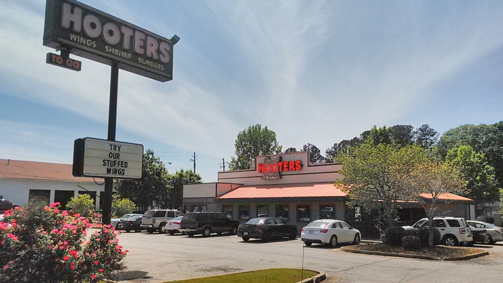
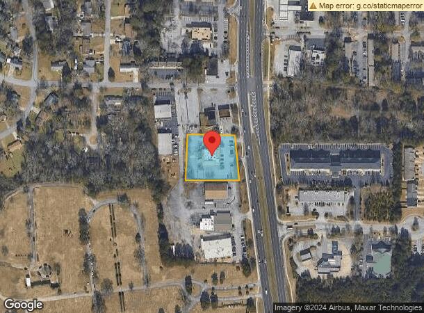
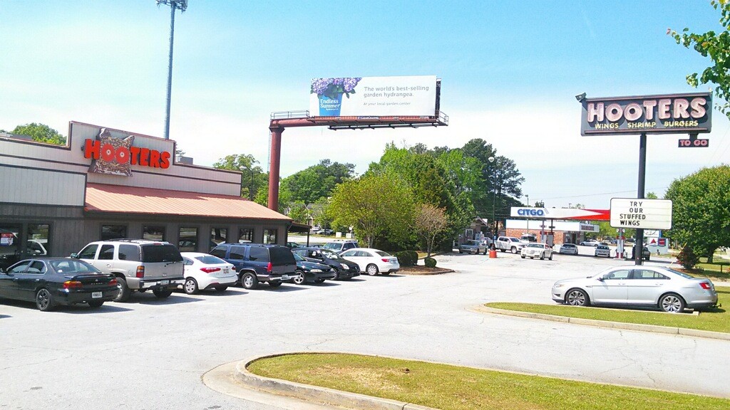
Property Record
6785 Tara Blvd, Jonesboro, GA 30236
NEARBY LISTINGS FOR SALE OR LEASE
Property Detail
6785 Tara Blvd
13-0147D-00A-003A
Hayes & Mathews Inc
Restaurantbuilding
Clayton
X
Georgia
13063C0078F
147
2024
1.14 AC
2024
Riverdale/Jonesboro
040423
Atlanta
4,896 SF
Atlanta-Sandy Springs-Roswell, GA
DEMOGRAPHICS near 6785 Tara Blvd
1 Mile
3 Mile
5 Mile
2024 Total Population
13,026
82,630
200,959
2029 Population
13,067
82,519
200,188
Pop Growth 2024-2029
+ 0.31%
(0.13%)
(0.38%)
Average Age
33
35
36
2024 Total Households
4,665
30,450
72,833
HH Growth 2024-2029
+ 0.24%
0.00%
(0.35%)
Median Household Inc
$43,201
$46,268
$46,973
Avg Household Size
2.70
2.60
2.70
2024 Avg HH Vehicles
2.00
2.00
2.00
Median Home Value
$118,793
$141,073
$158,555
Median Year Built
1975
1980
1982
Nearby Places
- Restaurants
- Banks
- Shops
- Fitness
- Groceries
PUBLIC TRANSPORTATION
AIRPORT
Hartsfield - Jackson Atlanta International
Drive
Walk
Distance
Hartsfield - Jackson Atlanta International
14 min
8.0 mi
Freight Ports
Georgia Ports - Savannah
Drive
Walk
Distance
Georgia Ports - Savannah
265 min
237.8 mi
SALE & LEASE HISTORY
LISTING DATE
SALE/LEASE

Mar 21, 2019
For Sale
Nearby Properties
Address
Land Use
TOTAL SIZE
Lot Size
Zoning
Address
Land Use
TOTAL SIZE
Lot Size
Zoning
518,648 SF
57.48 AC
MCD
Address
Land Use
TOTAL SIZE
Lot Size
Zoning
596 SF
57.40 AC
RM
Address
Land Use
TOTAL SIZE
Lot Size
Zoning
230 SF
27.08 AC
RM
Address
Land Use
TOTAL SIZE
Lot Size
Zoning
200 SF
23.02 AC
RM
Address
Land Use
TOTAL SIZE
Lot Size
Zoning
250 SF
31.25 AC
RM
Address
Land Use
TOTAL SIZE
Lot Size
Zoning
200,370 SF
23.81 AC
C
Address
Land Use
TOTAL SIZE
Lot Size
Zoning
387 SF
32.53 AC
RM
Address
Land Use
TOTAL SIZE
Lot Size
Zoning
218 SF
17.30 AC
RM
Address
Land Use
TOTAL SIZE
Lot Size
Zoning
220 SF
26.84 AC
RM
Address
Land Use
TOTAL SIZE
Lot Size
Zoning
196 SF
19.90 AC
C
Address
Land Use
TOTAL SIZE
Lot Size
Zoning
200 SF
18.36 AC
RM
Address
Land Use
TOTAL SIZE
Lot Size
Zoning
105,260 SF
12.67 AC
C
Address
Land Use
TOTAL SIZE
Lot Size
Zoning
410 SF
35 AC
RM
Address
Land Use
TOTAL SIZE
Lot Size
Zoning
212,048 SF
110.06 AC
HI
Address
Land Use
TOTAL SIZE
Lot Size
Zoning
188 SF
28.36 AC
RM
Address
Land Use
TOTAL SIZE
Lot Size
Zoning
200 SF
20.23 AC
RM
Address
Land Use
TOTAL SIZE
Lot Size
Zoning
351,207 SF
20 AC
HI
Address
Land Use
TOTAL SIZE
Lot Size
Zoning
108 SF
11.62 AC
C
Address
Land Use
TOTAL SIZE
Lot Size
Zoning
512,321 SF
21.28 AC
C
Address
Land Use
TOTAL SIZE
Lot Size
Zoning
8,046 SF
31.92 AC
C
Address
Land Use
TOTAL SIZE
Lot Size
Zoning
216 SF
22.12 AC
RM
Address
Land Use
TOTAL SIZE
Lot Size
Zoning
252 SF
27.14 AC
RM
Address
Land Use
TOTAL SIZE
Lot Size
Zoning
224 SF
25 AC
C
Address
Land Use
TOTAL SIZE
Lot Size
Zoning
210 SF
20.40 AC
RM
Address
Land Use
TOTAL SIZE
Lot Size
Zoning
144 SF
11.70 AC
MX
Address
Land Use
TOTAL SIZE
Lot Size
Zoning
208 SF
19.06 AC
C
Address
Land Use
TOTAL SIZE
Lot Size
Zoning
76,224 SF
15.25 AC
OI
Address
Land Use
TOTAL SIZE
Lot Size
Zoning
422,480 SF
19.42 AC
HI
Address
Land Use
TOTAL SIZE
Lot Size
Zoning
143,727 SF
13.52 AC
C
Address
Land Use
TOTAL SIZE
Lot Size
Zoning
265,041 SF
32.63 AC
HI
Start a new search to find other properties for sale or lease
Connect with us
© 2024 CoStar Group
The information above has been obtained from sources believed reliable. While we do not doubt its accuracy we have not verified it and make no guarantee, warranty or representation about it. It is your responsibility to independently confirm its accuracy and completeness. Any projections, opinions, assumptions, or estimates used are for example only and do not represent the current or future performance of the property. The value of this transaction to you depends on tax and other factors which should be evaluated by your tax, financial, and legal advisors. You and your advisors should conduct a careful, independent investigation of the property to determine to your satisfaction the suitability of the property for your needs.